Network Regions
The Middle-Mile Broadband Network is broken up into five regions across the state:
See the maps below to view which counties each region covers. View the table below to check on network construction progress within each region.
Information regarding the Last Mile Federal Funding Account (FFA) can be found on the California Public Utilities Commission’s website.
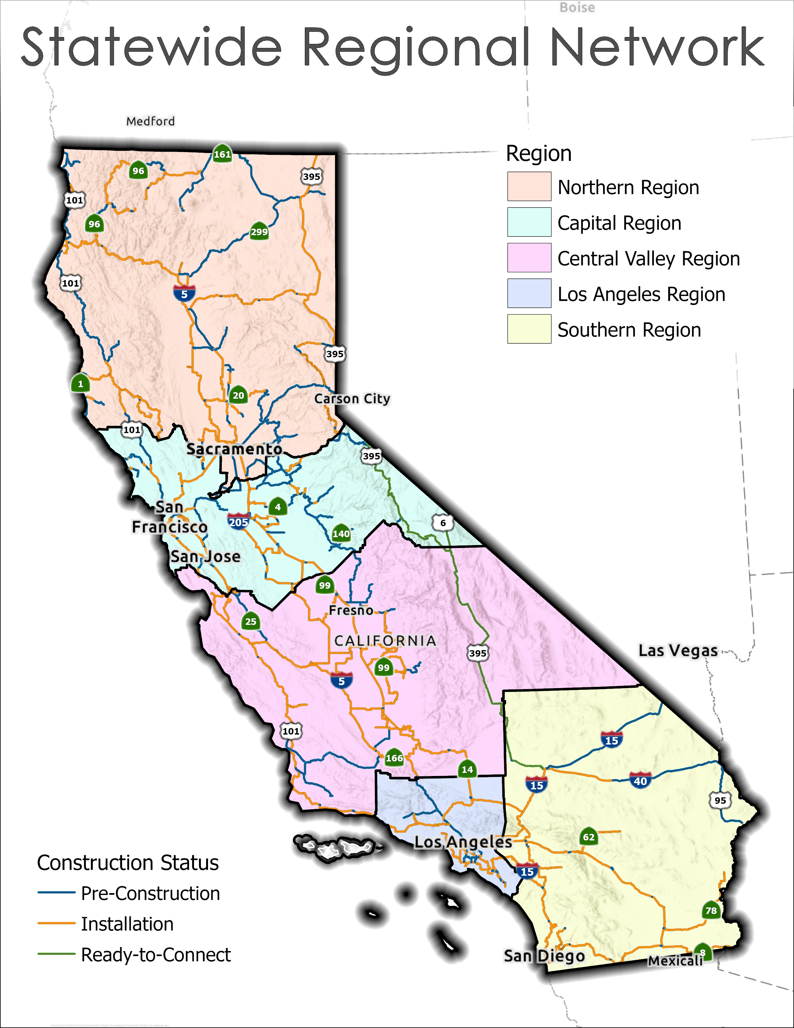
Statewide Regional Network Map Legend Guide:
- Blue lines: Pre-Construction
- Orange lines: Installation
- Green lines: Ready-to-Connect
- Peach color polygon: Northern Region
- Cyan color polygon: Capital Region
- Pink color polygon: Central Valley Region
- Periwinkle color polygon: Los Angeles Region
- Yellow color polygon: Southern Region
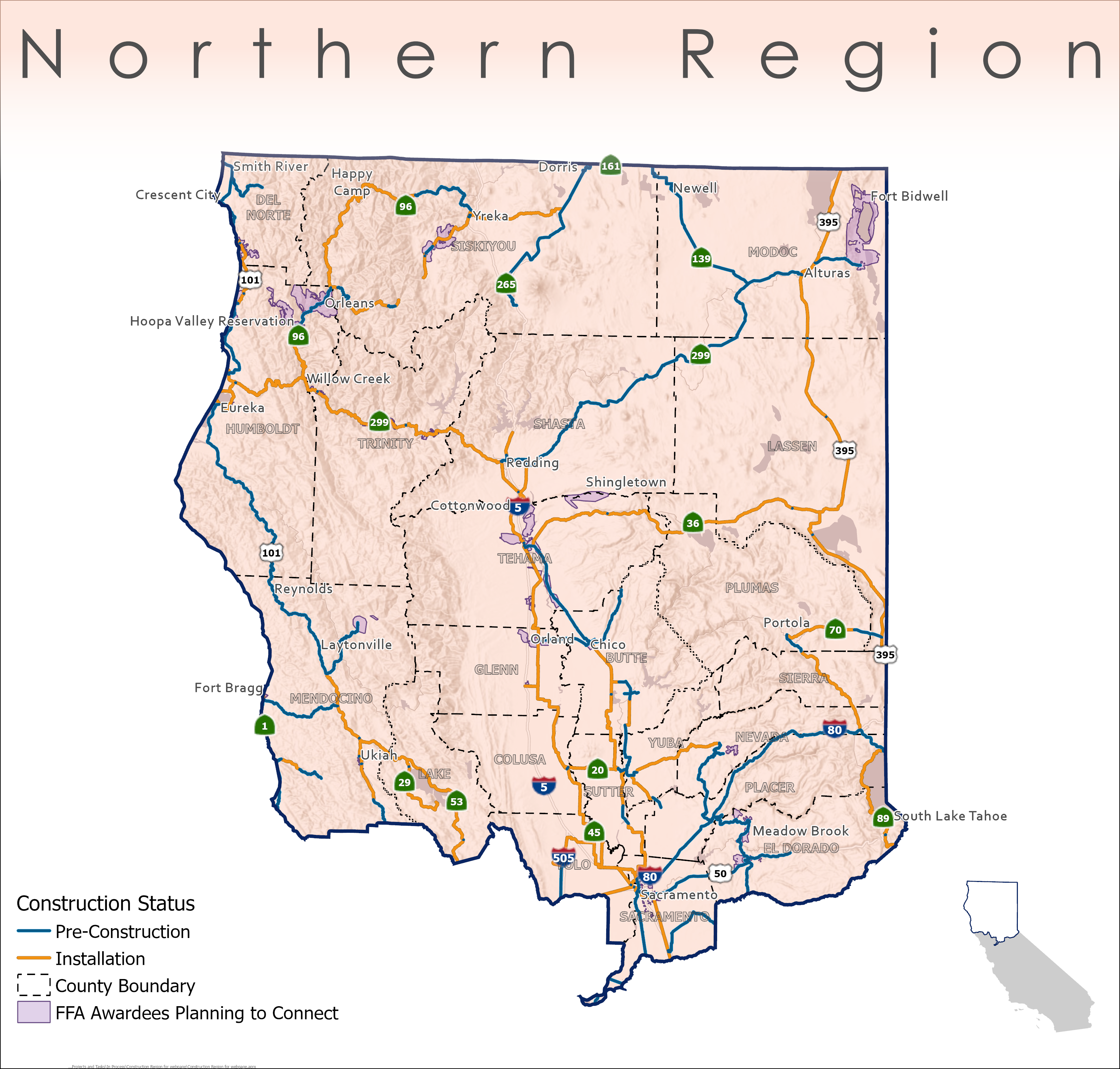
Northern Region Map Legend Guide:
- Blue lines: Pre-Construction
- Orange lines: Installation
- Outline in black dash polygon: County Boundary
- Lavender color polygon: FFA Awardees Planning to Connect
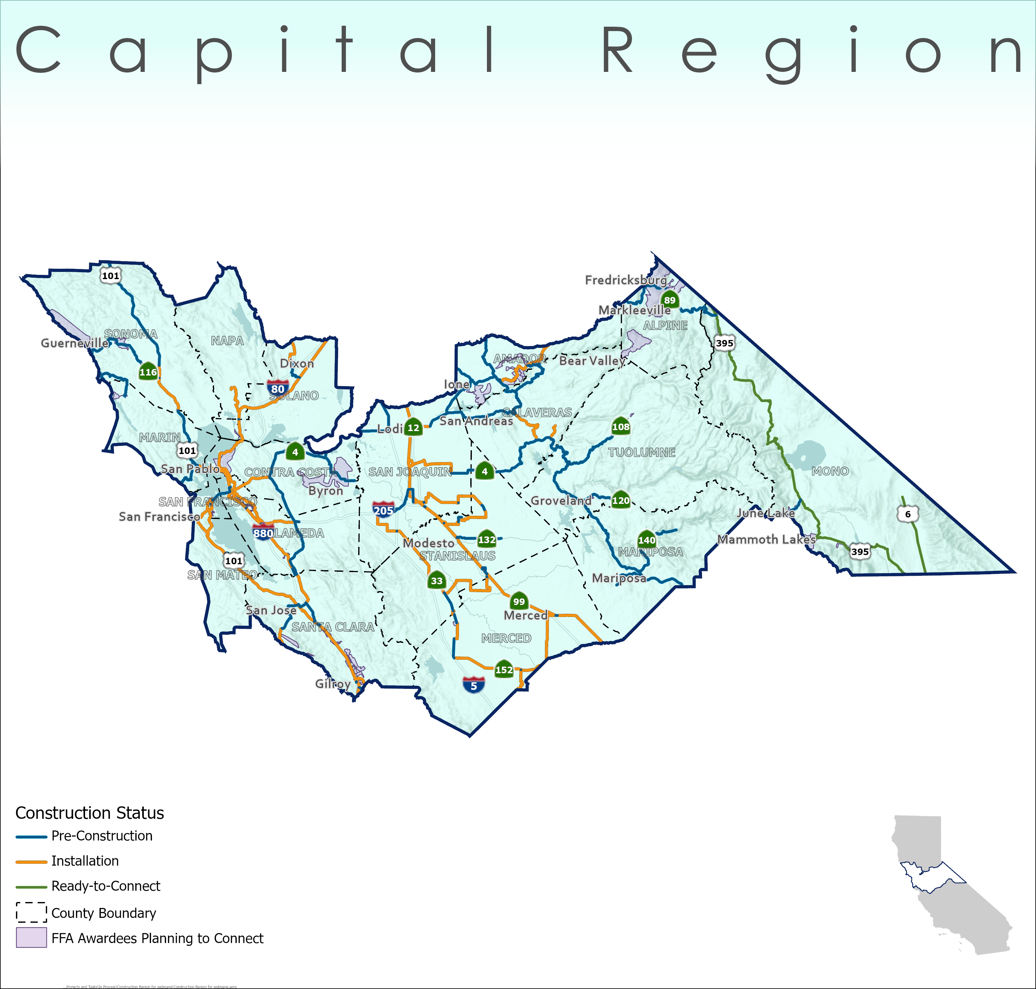
Capital Region Map Legend Guide:
- Blue lines: Pre-Construction
- Orange lines: Installation
- Green lines: Ready-to-Connect
- Outline in black dash polygon: County Boundary
- Lavender color polygon: FFA Awardees Planning to Connect
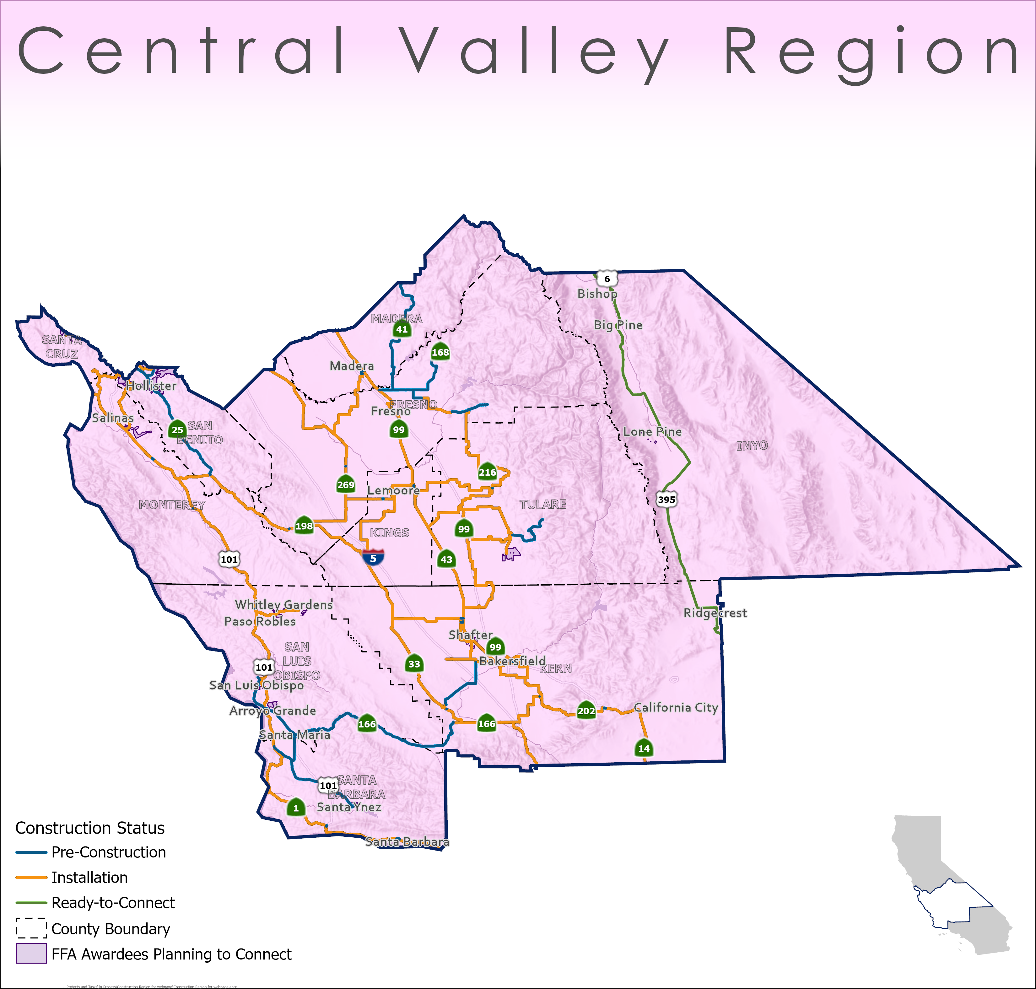
Central Valley Region Map Legend Guide:
- Blue lines: Pre-Construction
- Orange lines: Installation
- Green lines: Ready-to-Connect
- Outline in black dash polygon: County Boundary
- Lavender color polygon: FFA Awardees Planning to Connect
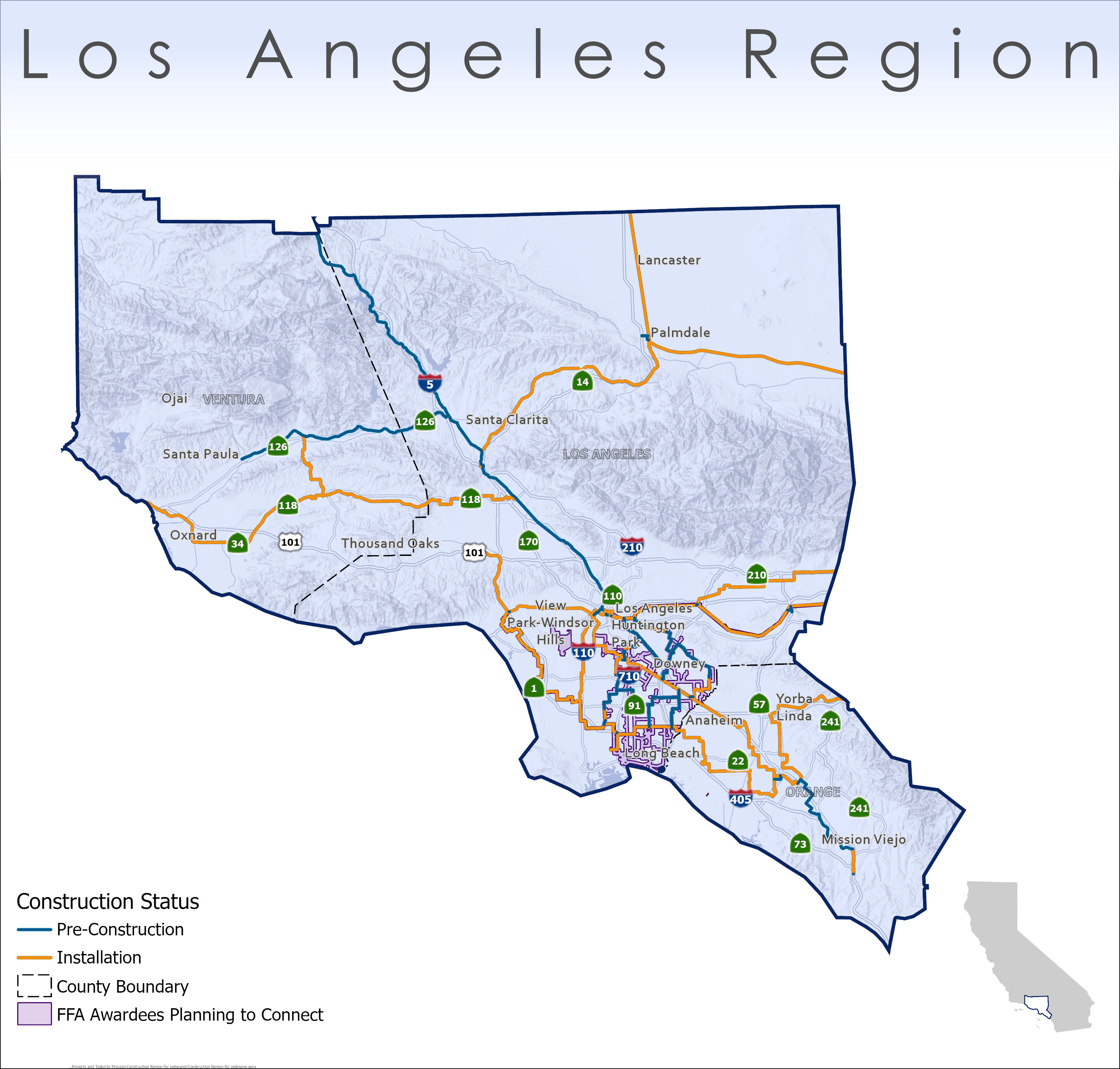
Los Angeles Region Map Legend Guide:
- Blue lines: Pre-Construction
- Orange lines: Installation
- Outline in black dash polygon: County Boundary
- Lavender color polygon: FFA Awardees Planning to Connect
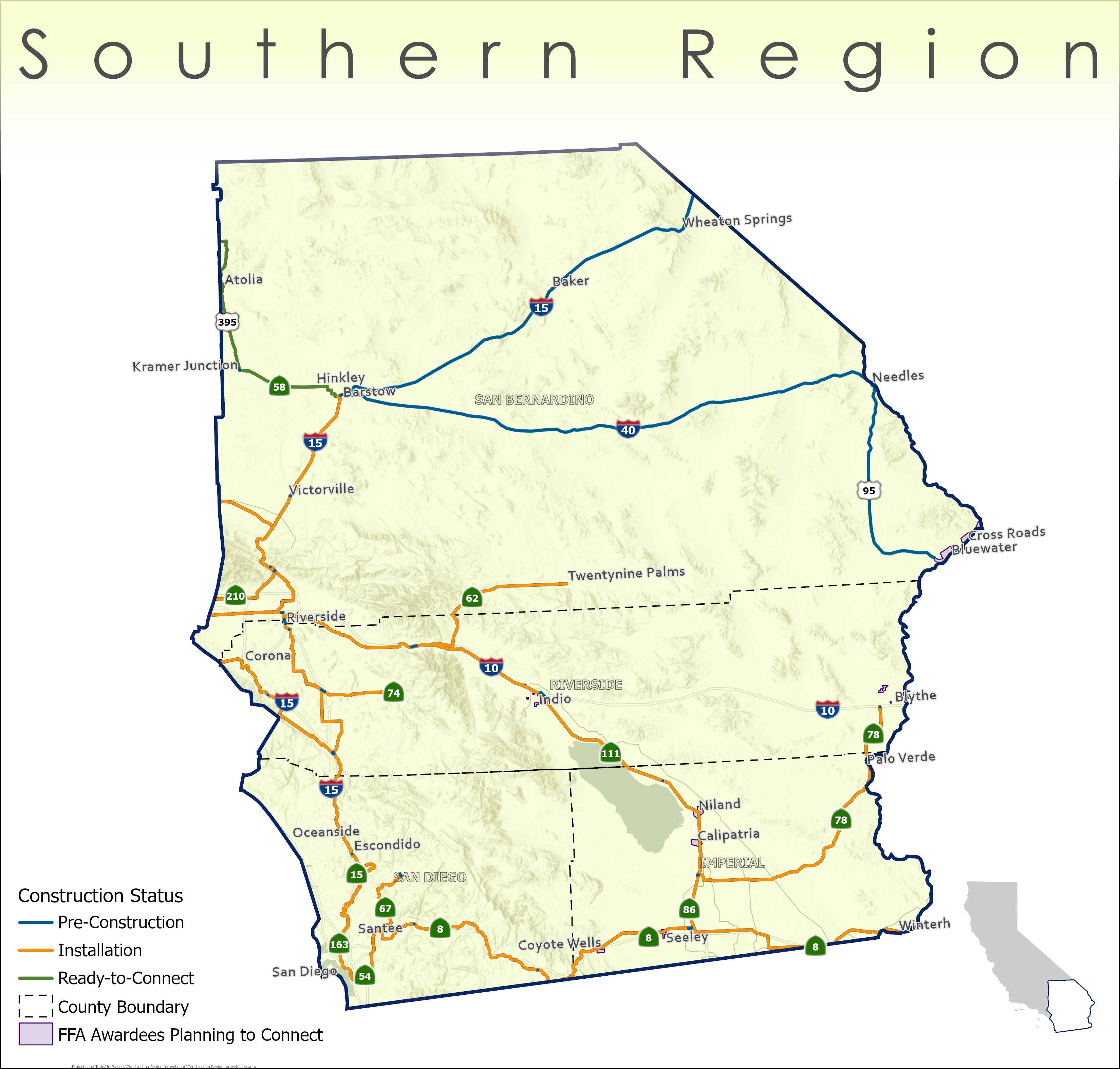
Southern Region Map Legend Guide:
- Blue lines: Pre-Construction
- Orange lines: Installation
- Green lines: Ready-to-Connect
- Outline in black dash polygon: County Boundary
- Lavender color polygon: FFA Awardees Planning to Connect
Network Miles by Region
Table Description:
- Region: Location of the network.
- Pre-Construction Miles: The activities are design, engineering, and permitting.
- Installation Miles: In the Installation status, the following activities are performed: Conduit Installation, Vault Placement, Fiber Pulling, Splicing, Hub Placement, Power Connection, and Electronics Installation.
- Ready-to-Connect Miles: In the Ready-to-Connect status, the following activities are performed: the network service center is established. Network testing occurs to confirm that segment(s) is operational and secure.
- Total Miles: Total network miles for region.
| Region | Pre-Construction Miles | Installation Miles | Ready-to-Connect Miles | Total Miles |
|---|---|---|---|---|
| Northern | 1,124.1 | 1,578.0 | 0 | 2,702.1 |
| Capital | 628.1 | 845.5 | 175.3 | 1,648.9 |
| Central Valley | 393.9 | 1,405.6 | 178.7 | 1,978.2 |
| Los Angeles | 174.6 | 443.8 | 0 | 618.4 |
| Southern | 338.3 | 854.5 | 69.0 | 1,261.8 |
| Grand Total Miles | 2,659.0 | 5,127.4 | 423.0 | 8,209.4 |
Note: Installation miles reflect segments where physical construction is actively underway. In any given month, additional miles may have been permitted by partners who have not yet broken ground. Those miles will be reflected here as construction begins.
Updated June 29, 2026
Regional Data
Construction Regions – Download a CSV, Shapefile, GeoJSON, and/or KML data file of the current network construction progress within each region.